The incredible Blue Ridge Parkway is a 469-mile recreational motor road that connects Shenandoah and Great Smoky Mountains National Parks while protecting the cultural and natural features of the region. Designed as a "scenic drive," the Parkway provides both stunning scenery and close-up looks at the natural and cultural history of the mountains. The Blue Ridge Parkway is also the access point to many great hikes within a 20-30-minute drive of Asheville.
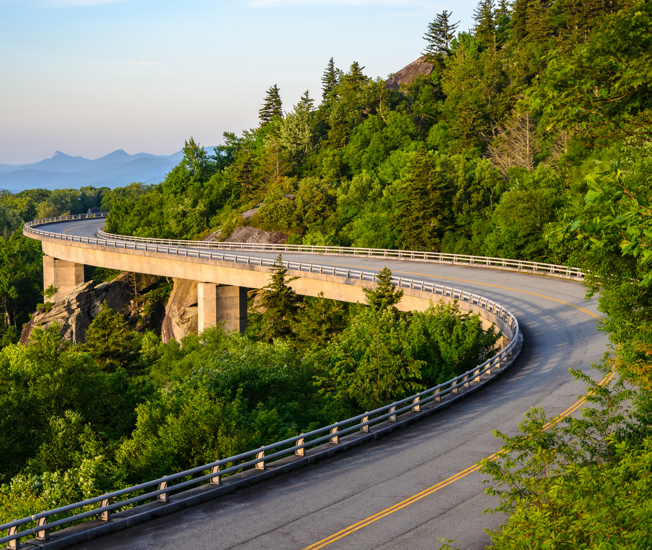
The frequently photographed Linville Cove Viaduct on the BRP.
In 2021, the Blue Ridge Parkway Association (BRPA) marked all tunnels along the iconic roadway with signs denoting heights and location. Their new interactive map will certainly help you make the most of your adventures there, but if you need some recommendations to get you started, we've listed some of our favorite spots on the Blue Ridge Parkway below that are around an hour of drive time or less from Asheville!
- Craggy Gardens - If you're on a time crunch, but want to experience a quick hike off of the Blue Ridge Parkway, Craggy Gardens is a popular choice, particularly the Craggy Pinnacle Trail which is a 1.2-mile round trip hike. Located at mile marker 364.1, the Craggy Gardens area offers a picnic area, a Visitor Center with restrooms, and hikes near the picnic area as well as the Craggy Pinnacle trail access area which is past the Visitor Center if you're headed north on the Parkway.
- Graveyard Fields and Black Balsam - Located at Milepost 418.8 on the Blue Ridge Parkway, Graveyard Fields, has it all: family-friendly hikes, waterfalls, and summer options for blueberry picking. The name Graveyard Fields comes from the appearance of the area after logging and fire had taken its toll on the forest and soil and left tree stumps that looked like gravestones. Ready for more after your Graveyard Fields waterfall hike? Located at Milepost 420.2, Black Balsam does require more of a hilly climb but offers beautiful views from its mountain bald.
- Mount Pisgah - with its summit over 5,700 feet, Mount Pisgah can be spotted from downtown Asheville. The 2.6 round trip trail up to Mount Pisgah's summit has a moderate difficulty rating but the views reward you from every angle once you make it to the top. Within proximity of the trail access is the Pisgah Inn and Restaurant. The restaurant offers a great spot to grab a bite to eat or sit on the back porch area and enjoy a cold brew or glass of wine. Mount Pisgah is located at mile marker 408. The hike to the tallest mountain east of the Mississippi River, Mt. Mitchell (Milepost 355), is actually a 14-mile hike from the Montreat area, but most people access Mount Mitchell from the Blue Ridge Parkway. Mt. Mitchell grounds include the popular summit which is accessible and paved to the top, as well as a whole network of trails to areas such as Commissary Ridge.
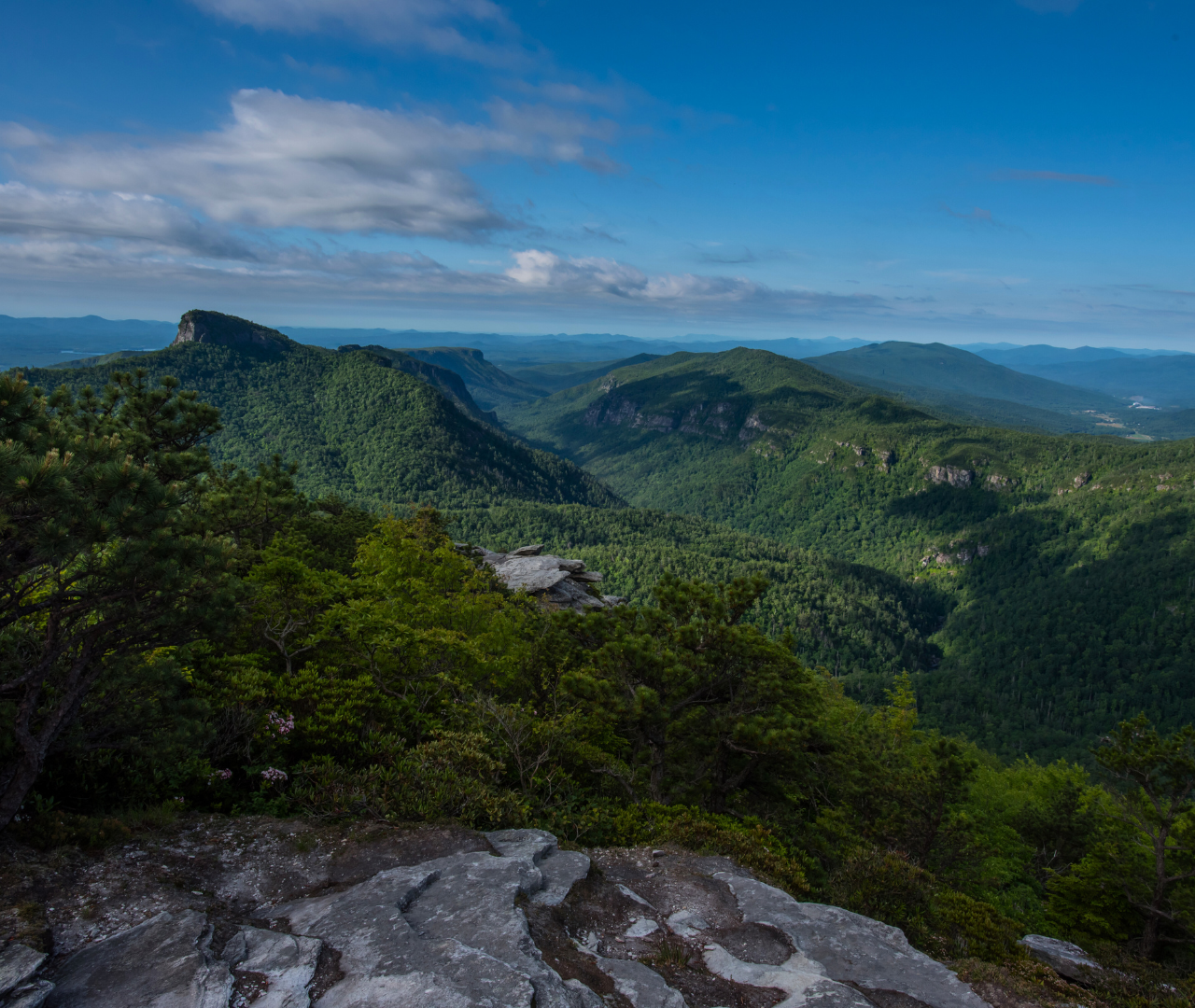
Linville Gorge Wilderness area.

Willing to drive a little further?
From Asheville, a 1 hour and 30-minute northbound drive on the Parkway will bring you to Linville Gorge wilderness, or the "Grand Canyon of the East," which has access to some of the most rugged and beautiful spots in our area like Hawksbill Trail, Table Rock Picnic area and trail, Shortoff Trail, and easier access areas such as Linville Falls, located at Milepost 316.
During the winter months, parts of the Blue Ridge Parkway are closed. Check out their website to find the real-time closures map.